
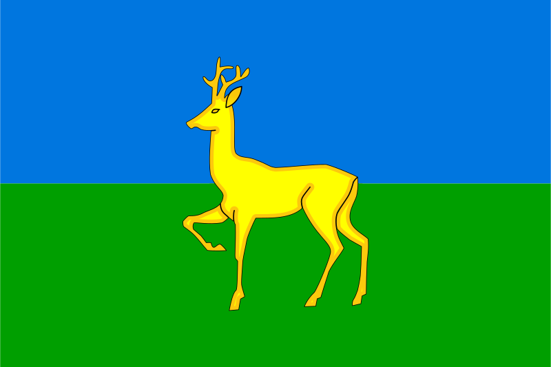
About the flag
Dzerzhinsky District uses an official municipal flag based on district heraldry. The main emblematic elements identify the territory, while no uncertain color symbolism or secondary interpretation is provided.
Dzerzhinsky District — available formats: SVG, PNG, JPG, WebP, PDF. Choose an image size. No sign-up needed
Click a HEX or RGB value to copy it.
Dzerzhinsky District uses an official municipal flag based on district heraldry. The main emblematic elements identify the territory, while no uncertain color symbolism or secondary interpretation is provided.
Region · Russia
Dzerzhinsky District lies in eastern Krasnoyarsk Krai in central Siberia, where taiga forests, river valleys, farmland, wetlands, and small rural settlements dominate the landscape. The district is largely forested and lightly urbanised. Today agriculture, forestry-related industries, public services, local transport, food production, and small businesses support the economy. Roads link the administrative center and villages with nearby districts and railway corridors, while forests, rivers, hunting areas, and open countryside remain important to livelihoods and recreation.
The Yenisei valley opens into a broad steppe basin beneath southern Siberian mountains.
Taiga forests, rivers, and agricultural clearings cover the eastern Siberian interior.

Forested Caucasus foothills rise above fertile plains in the northwest.

Dry steppe valleys and low mountain ridges cover southeastern Transbaikalia.